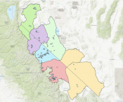
Maps & GIS
![Capture locations](https://www.bistatesagegrouse.com/sites/default/files/styles/full_node_additional_two_column/public/imageattachments/general/page/401/screen_shot_2019-08-01_at_10.51.26_am.png?itok=cCnVnV1D)
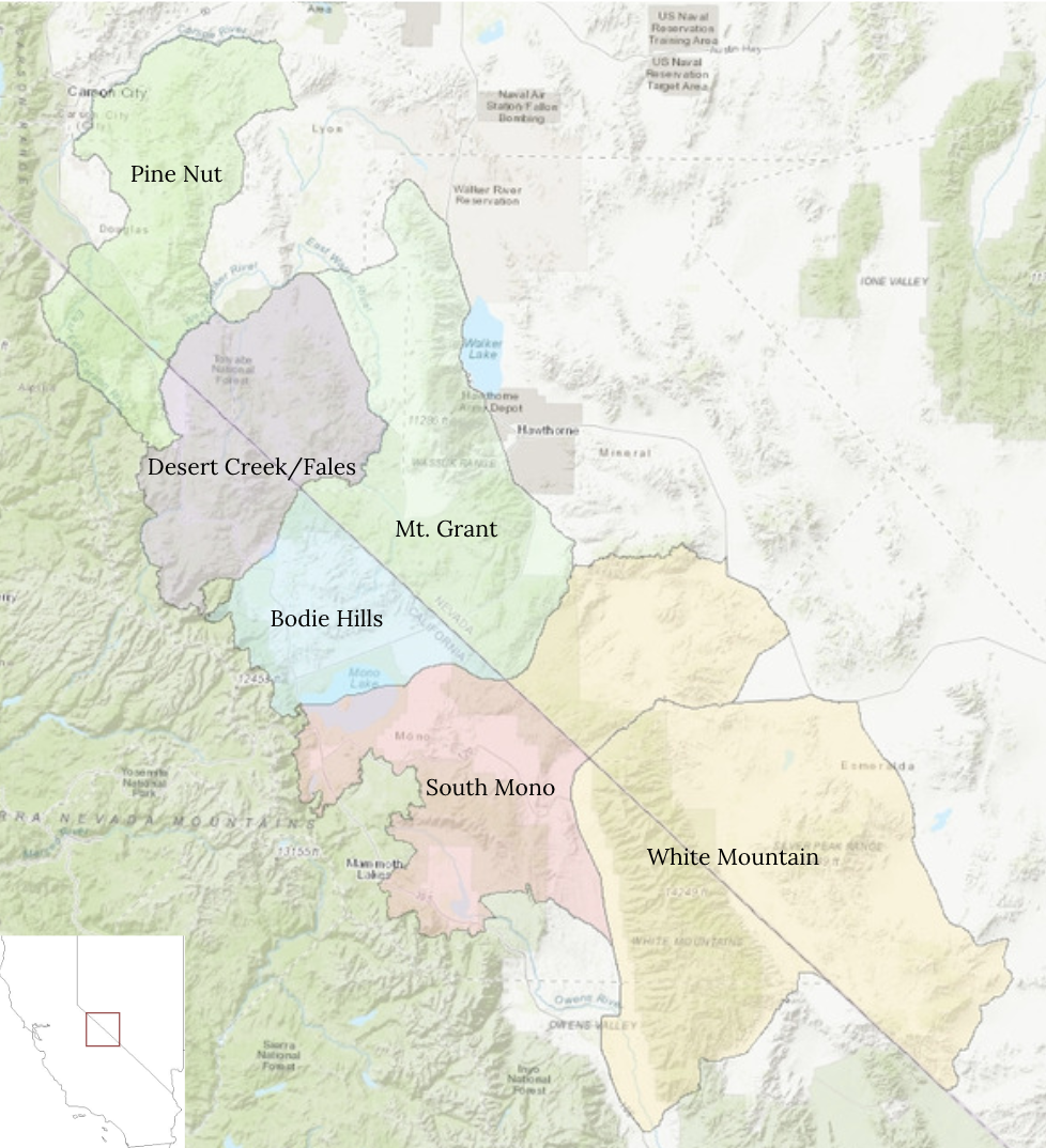
Bi-State Sage-Grouse Capture Locations
![Nest and brood locations](https://www.bistatesagegrouse.com/sites/default/files/styles/full_node_additional_two_column/public/imageattachments/general/page/401/screen_shot_2019-08-01_at_10.51.35_am.png?itok=kCG2fQV6)
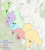
Nest and Brood Locations
![Known lek locations](https://www.bistatesagegrouse.com/sites/default/files/styles/full_node_additional_two_column/public/imageattachments/general/page/401/screen_shot_2019-08-01_at_10.51.58_am.png?itok=vUW0a8p7)
Known Lek Locations
![Known sage-grouse locations](https://www.bistatesagegrouse.com/sites/default/files/styles/full_node_additional_two_column/public/imageattachments/general/page/401/screen_shot_2019-08-01_at_10.50.33_am.png?itok=6I4dF4LK)
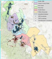
GPS and VHF Locations and Modeled Sage-Grouse Habitat
Download the sage-grouse Resource Selection Function map here
![Vegetation monitoring plots](https://www.bistatesagegrouse.com/sites/default/files/styles/full_node_additional_two_column/public/imageattachments/general/page/401/screen_shot_2019-08-01_at_10.52.29_am.png?itok=uPc6CCXx)
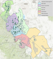
Vegetation Monitoring Plot Locations
![Mapped conifer](https://www.bistatesagegrouse.com/sites/default/files/styles/full_node_additional_two_column/public/imageattachments/general/page/401/screen_shot_2019-08-01_at_10.53.53_am.png?itok=Tikex9aI)
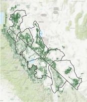
Bi-State Conifer Cover Map Developed by USGS
![Conservation action locations](https://www.bistatesagegrouse.com/sites/default/files/styles/full_node_additional_two_column/public/imageattachments/general/page/401/screen_shot_2019-08-01_at_10.52.48_am.png?itok=I-m-aEEW)
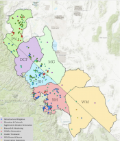
Implemented Conservation Action Locations